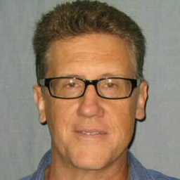
Greg Wroblicky
Fähigkeiten und Kenntnisse
Werdegang
Berufserfahrung von Greg Wroblicky
- Bis heute 10 Jahre und 2 Monate, seit 2016
(Geo) Environmental Scientist
California Department of Pesticide Regulation
Geospatial analysis and assessment of historic pesticide exposure incidents and demography to provide analytical support for human and environmental pesticide exposure mitigation. Agricultural worker fumigant pesticide exposure monitoring studies. Evaluation of pesticide product registration studies and data submittals.
- 2007 - 2012
Project Manager/GIS Analyst
Pro2Serve
Development, implementation and management of Geographic Information System (GIS) related geospatial products and services using the ESRI ArcGIS software suite to support environmental facility cleanup, watershed analysis, facility footprint reduction, geospatial data quality, risk management, and project management at DOE Oak Ridge Reservation’s ETTP, ORNL, and Y-12 sites, Oak Ridge, Tennessee, the UMTRA Moab project, and the U.S. DOE National Nuclear Security Administration Pantex Plant.
- 2006 - 2007
GIS Database Specialist
City of Johnson City Water and Sewer Department
Responsible for design, creation, implementation, maintenance, and management of the department’s water and sewer infrastructure GIS database using ESRI ArcGIS/ArcSDE enterprise software. Work included database design, GPS infrastructure surveys, conversion of engineering design data conversion, spatial and network analysis, and cartographic production. Supervised personnel and conducted training workshops, assisted with infrastructure maintenance projects and worked with outside contractors and agencies.
- 2003 - 2005
GIS Analyst
Tennessee Valley Authority
Geospatial (GIS) analysis and mapping of watershed protection projects for rivers in Tennessee and North Carolina using ESRI ArcGIS. Developed GIS watershed survey and restoration project databases, simulated watershed pollution loads and water quality benefits for different best-management practices using watershed models. Wrote watershed restoration plans and agricultural farm conservation plans. Conducted stream habitat and biologic surveys, and water quality and quantity sampling and evaluation.
- 2004 - 2004
Adjunct Faculty Instructor in GIS
Pellissippi State Community College
Course instructor for course entitled GIS Data Sources and Data Quality. Course consisted of weekly lectures and hands-on computer laboratory sessions covering the fundamentals of obtaining, constructing, and analyzing vector and raster data to construct geographic information systems using ESRI ArcGIS software.
- 1994 - 2003
Hydrogeologist
Jacobs Engineering Group, Inc.
Professional hydrogeologist specializing in environmental site characterization and sampling, and the construction and review of unsaturated and saturated zone flow and solute transport models for evaluation of contaminant fate and transport, remedial design, risk assessment, groundwater-surface water interactions, and groundwater supply in a variety of different watershed environments.
- 1991 - 1993
Research Associate
Earth and Planetary Sciences Dept., University of New Mexico, Albuquerque
Graduate research focused on mathematical modeling of groundwater/stream interactions in watersheds located in northern New Mexico as part of NSF sponsored inter-departmental research program studying the hydrology and ecology associated with groundwater/stream water interactions (hyporheic zone) in headwater streams.
- 1988 - 1991
Geologist
ENSR International Corporation
Managed and conducted environmental site characterizations of sites with suspected contamination of soil, surface water and groundwater. ENSR International Corporation was acquired by AECOM Technology Corporation in 2005.
---
GIS
Ausbildung von Greg Wroblicky
- 2003 - 2005
Geographic Information Systems
Pellissippi State Technical Community College
- 1991 - 1995
Geological and Earth Sciences/Geosciences
The University of New Mexico
- 1989 - 1990
Hazardous Materials Management
University of California, Berkeley, Extension
- 1980 - 1985
Biology
Crown College, University of California, Santa Cruz
- 1980 - 1985
Geological and Earth Sciences/Geosciences
Crown College, University of California, Santa Cruz
Sprachen
Deutsch
Grundlagen
Englisch
Muttersprache
XING – Das Jobs-Netzwerk
Über eine Million Jobs
Entdecke mit XING genau den Job, der wirklich zu Dir passt.
Persönliche Job-Angebote
Lass Dich finden von Arbeitgebern und über 20.000 Recruiter·innen.
21 Mio. Mitglieder
Knüpf neue Kontakte und erhalte Impulse für ein besseres Job-Leben.
Kostenlos profitieren
Schon als Basis-Mitglied kannst Du Deine Job-Suche deutlich optimieren.
