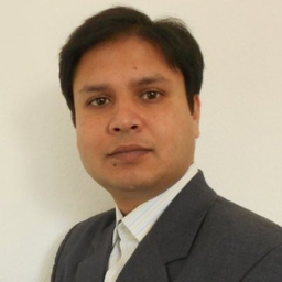
Md. Asraful Latif
Fähigkeiten und Kenntnisse
Werdegang
Berufserfahrung von Md. Asraful Latif
- Bis heute 5 Jahre und 1 Monat, seit Feb. 2021
Netzplaner FTTX
D-Net Telekommunikation GmbH
- 5 Jahre und 11 Monate, März 2015 - Jan. 2021
Geoinformation Specialist
self employement
Project planning and design - Working with Geo Database, Geospatial analysis and mapping, PostGIS database development, - 3D modelling of Historical Buildings and places using Photograph and Civil 3D Modeling Techniques - Satellite image interpretation and analysis, Web GIS, Spatial Data Infrastructure, Website development
- 5 Monate, Okt. 2014 - Feb. 2015
Scientific Research Assistant (Project: Open4GeoIT)
Stuttgart University of Applied Sciences, Stuttgart, Germany
Development and implementation "height deployment of global elevation models considering different interpolation" - Ubuntu Server Administration and Maintenance, PostGIS database development with SRTM data - QGIS analysis and customization with python plugin builder
- 3 Monate, Okt. 2014 - Dez. 2014
Academic Research Assistant (Project: GIS and Remote Sensing)
Stuttgart University of Applied Sciences, Stuttgart, Germany
New Software packages analysis in the GIS and Remote Sensing laboratory Develop tutorials, academic exercises and LAB lectures for the students, Teaching assistance
- 3 Monate, Juni 2013 - Aug. 2013
Research Assistant (WebGIS)
Stuttgart University of Applied Sciences, Stuttgart, Germany
Spatial Data Infrastructure (SDI) Development and administration using Open Source GIS Technology. Geodatabase with ALKIS and ATKIS data, processing and analyse geographic data and uploading in the Geo-server, project documentation, Lectures in GIS and WebGIS application at the MSc module “GIS”
- 2 Monate, Nov. 2012 - Dez. 2012
Consultant (3D City Modelling)
Stadtmessungsamt, Stuttgart, Germany
- Import /export in 3D multi-formats- enabling user to read and export their 2D and 3D data in numerous applications Optimize and structure 3D data, Conversion tools specialized in the processing of 2D and 3D GIS data.
- 2 Jahre und 1 Monat, Juli 2009 - Juli 2011
GIS Specialist
SMEC International Pty Ltd. ,Dhaka, Bangladesh
- Collect and synthesize Geodata using GPS, Satellite Image Interpretation, analysis and digitization - Geodatabase management, processing and analysis - ArcGIS Server administration, Web Geo Service creation - Project report and presentation preparation - ArcGIS and QGIS customization using Python
- 2 Jahre und 11 Monate, Aug. 2006 - Juni 2009
Photogrammetrist
The Decode Ltd. Dhaka, Bangladesh
- 3D City Modeling in LOD 2 for European Cities, Project setup and management activity - Satellite image interpretation and analysis with ERDAS Imagine - ArcGIS Server administration, Web GIS development, ArcGIS customization with Visual Basic
- 7 Monate, Jan. 2005 - Juli 2005
Junior GIS Specialist
SMEC International Pty Ltd. ,Dhaka, Bangladesh
- Planning and design Geo data collection process and Conducting filed Geo data collection - Geo database and Base map preparation - Satellite Imagery analysis, Interpretation and Digitization - Linking Socio-economic and environmental survey data with Geospatial data - Socio-econimic and Geo data analysis and analytical map preparation
Ausbildung von Md. Asraful Latif
- 1 Jahr und 6 Monate, Okt. 2011 - März 2013
Photogrammetry and geoinformatics
Hft-stuttgart
Photogrammetry, Remote Sensing, GIS, Web Technology, Software development
- 4 Jahre und 4 Monate, Sep. 2000 - Dez. 2004
Urban and Rural Planning
Khulna University
Urban and Rural Planning and development, GIS, Remote Sensing, Statistics, Environmental Studies
Sprachen
Englisch
Fließend
Deutsch
Gut
XING Mitglieder mit ähnlichen Profilangaben
XING – Das Jobs-Netzwerk
Über eine Million Jobs
Entdecke mit XING genau den Job, der wirklich zu Dir passt.
Persönliche Job-Angebote
Lass Dich finden von Arbeitgebern und über 20.000 Recruiter·innen.
21 Mio. Mitglieder
Knüpf neue Kontakte und erhalte Impulse für ein besseres Job-Leben.
Kostenlos profitieren
Schon als Basis-Mitglied kannst Du Deine Job-Suche deutlich optimieren.
