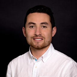
Sebastian Ojeda
Fähigkeiten und Kenntnisse
Werdegang
Berufserfahrung von Sebastian Ojeda
- Bis heute 2 Jahre und 9 Monate, seit Juni 2023
Technical Support Specialist
Hexagon Geosystems
- International support level 2 for hardware and corresponding software of BLK product line. - Identifying and recreating reoccurring, systematic or complex problems - Developing and sharing workflow solutions and technical documentation - Testing BLK products and giving feedback on technical test results to the product developer team - Close cooperation with regional support and sales teams as well as product management
- Commissioning VMT navigation systems and technical management of tunnel construction projects worldwide. - Timely execution and support of Large Diameter Tunnels projects with high-quality standards/customer satisfaction. - Organization and careful processing of the assigned orders and projects concerning quality and deadlines, as well as controlling the technical-commercial processing. - Ensuring the implementation of processes and innovations, guaranteeing the quality of the service provided.
- Uploading, updating and processing raster and vector data to the Outdooractive platform from official spatial data sources such as IGN France, BGK Germany and Swisstopo Switzerland. - Engaged in the automation of data processes and the generation of models to support data analysis. - Responsible for the continuous improvement of the geodata infrastructure and the generation of new geodata based on the contents of the Outdooractive platform.
- Master Thesis development “Mobile 3D Data Capture using Panorama Photos, 2D Mapping and Spherical Photogrammetry. - Participation, organization, assistance, and execution of innovation projects for clients in the (mobile) laser scanning field. - Contribution to data acquisition from research projects, and comparison of methods from different laser scanners on the research campus. - Working student for the Labs Department supporting the scanning automation in ARENA 2036.
- 9 Monate, Jan. 2018 - Sep. 2018
Cadastral and Surveyor Specialist
Agencia Nacional de Tierras
Generation of methodological contributions and support in the implementation of the multipurpose cadastre in IOM (International Organization for Migration) and UNPD (United Nations Development Programme) projects in Colombia. Perform topographical concepts and technical guidance to land surveyors and validation of several products like planimetric survey, DTM’s, DEM’s, Orthophotos, Cadastral files and Geodatabases.
- 2 Jahre und 11 Monate, Aug. 2015 - Juni 2018
Professor
Universidad Distrital Francisco Jose de Caldas
Part-time professor teaching the following modules: - Planimetry - Measurement, Survey and Geometric design of Roads and Highways - Special Surveying - Automated Surveying
- 8 Monate, Mai 2017 - Dez. 2017
GIS Specialist
360° GeoIngenieria
Analysing and designing digital maps and spatial data through the use of mapping software Develop mapping applications and tools for the optimization of the Company's workflows. Perform data capture (Aerial images with UAV, Aerial and Terrestrial Laser Scanning).
- 6 Monate, Sep. 2016 - Feb. 2017
GIS Specialist
Caja de la Vivienda Popular
Provide professional services to the Resettlement Department, in the process of structuring the Geographic Information System (GIS), inventory of space objects and management of cartographic and alphanumeric information in the various processes in charge of the Department.
- 11 Monate, Okt. 2015 - Aug. 2016
Chief Surveyor
360° GeoIngenieria
Planning, coordination, execution and supervision of topographic projects, generation and revision of quality mapping, creation and modelling of Geodatabase, survey and data collection. Handling and processing of Lidar data, UAV Drone flights, DTM and/or DEM generation, orthophotos.
- 7 Monate, März 2015 - Sep. 2015
Professional Land Surveyor
Grupo Posso
Land Surveyor Controller, Planner and Supervisor of construction work for the 50 kilometres road from the municipality of "San Benito Abad" to "Sampués" (Sucre, Colombia).
- 9 Monate, Juni 2014 - Feb. 2015
Professional Land Surveyor
Grupo Tradeco
Verify the accuracy of survey data, including measurements and calculations conducted at survey locations on the adequacy of electric infrastructure on the Ecopetrol's oilfields. Locate and mark sites selected to build the electric infrastructure inside the Ecopetrol's oilfields.
Ausbildung von Sebastian Ojeda
- 3 Jahre und 5 Monate, Okt. 2018 - Feb. 2022
M.Sc. Photogrammetry and Geoinformatics
Hochschule für Technik Stuttgart
- 1 Jahr und 1 Monat, Jan. 2016 - Jan. 2017
Specialization in Geographic Information Systems
Universidad Distrital Francisco José de Caldas
Spatial Databases, GIS, Remote Sensing, Programming, Geostatistics
- 4 Jahre und 11 Monate, Feb. 2008 - Dez. 2012
Surveying Engineering
Universidad Distrital Francisco José de Caldas
Land Surveying, Geomatics, Cartography, Remote Sensing, GIS
Sprachen
Spanisch
Muttersprache
Englisch
Fließend
Deutsch
Fließend
Französisch
Grundlagen
XING Mitglieder mit ähnlichen Profilangaben
XING – Das Jobs-Netzwerk
Über eine Million Jobs
Entdecke mit XING genau den Job, der wirklich zu Dir passt.
Persönliche Job-Angebote
Lass Dich finden von Arbeitgebern und über 20.000 Recruiter·innen.
21 Mio. Mitglieder
Knüpf neue Kontakte und erhalte Impulse für ein besseres Job-Leben.
Kostenlos profitieren
Schon als Basis-Mitglied kannst Du Deine Job-Suche deutlich optimieren.
