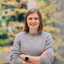
Dr. Sophie Crommelinck
Fähigkeiten und Kenntnisse
Werdegang
Berufserfahrung von Sophie Crommelinck
- Bis heute 4 Jahre und 3 Monate, seit Dez. 2021Netze BW GmbH - Ein Unternehmen der EnBW AG
Product Owner
- 2 Jahre und 7 Monate, März 2020 - Sep. 2022
Lecturer Geographic Information Systems (GIS)
Hochschule Karlsruhe - Technik und Wirtschaft
- 1 Jahr und 10 Monate, Feb. 2020 - Nov. 2021Netze BW GmbH - Ein Unternehmen der EnBW AG
IT Business Analyst for Geospatial Systems
- 4 Jahre, Feb. 2016 - Jan. 2020
PhD Researcher
University of Twente, Faculty of Geo-Information and Earth Observation (ITC)
During my PhD (2016-2020), I aimed to facilitate current land rights mapping by extracting visible cadastral boundaries from remote sensing data. During that time, I have developed a boundary delineation tool that combines image analysis, machine learning, and GIS functionalities (https://its4land.com/automate-it-wp5/). My PhD thesis entitled is publically available: https://research.utwente.nl/en/publications/automating-image-based-cadastral-boundary-mapping
- 1 Jahr, Aug. 2014 - Juli 2015
Research Assistant
Heidelberg University (Depart. of Geography)
Student assistant in European cap4access project and in quantitative and qualitative analysis of volunteered geographical information (VGI)
- 2 Monate, Jan. 2014 - Feb. 2014
Student Employee
Esri Belux
Updating of ArcGIS Online database, Participation at ArcGIS workshops
- 2 Monate, Feb. 2013 - März 2013
Student Employee
Leibniz Institute for Regional Development and Structural Planning (IRS)
Investigating geographical dimensions of energy transition
- 4 Monate, Okt. 2012 - Jan. 2013
Student Employee
Baader Konzept (agency for environmental planning)
Maintenance of database system
- 4 Monate, Sep. 2012 - Dez. 2012
Student Employee
GEF Leimen (agency for district heat planning)
Maintenance of database system, Creation of consumption maps (ArcGIS)
Ausbildung von Sophie Crommelinck
- 7 Monate, Aug. 2017 - Feb. 2018
Geoinformatics
Ruprecht-Karls-Universität Heidelberg
Research visit in GIScience group
- 4 Jahre und 1 Monat, Feb. 2016 - Feb. 2020
Geoinformatics
University of Twente
Image Analysis, Remote Sensing, Machine Learning, Computer Vision
- 1 Jahr und 4 Monate, Okt. 2014 - Jan. 2016
Geoinformatics
Ruprecht-Karls-Universität Heidelberg
Minor subjects: Computer Science, Economics
- 5 Monate, Aug. 2013 - Dez. 2013
Geoinformatics
Université Paul Valéry - Montpellier III
- 2 Jahre und 11 Monate, Okt. 2011 - Aug. 2014
Geography
Ruprecht-Karls-Universität Heidelberg
Minor subjects: Urban Planning, Public Law
Sprachen
Deutsch
Muttersprache
Niederländisch
Fließend
Französisch
Fließend
Englisch
Fließend
XING Mitglieder mit ähnlichen Profilangaben
XING – Das Jobs-Netzwerk
Über eine Million Jobs
Entdecke mit XING genau den Job, der wirklich zu Dir passt.
Persönliche Job-Angebote
Lass Dich finden von Arbeitgebern und über 20.000 Recruiter·innen.
21 Mio. Mitglieder
Knüpf neue Kontakte und erhalte Impulse für ein besseres Job-Leben.
Kostenlos profitieren
Schon als Basis-Mitglied kannst Du Deine Job-Suche deutlich optimieren.
