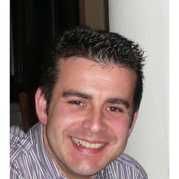
Miguel J. Cárdenas Herrera
Fähigkeiten und Kenntnisse
Werdegang
Berufserfahrung von Miguel J. Cárdenas Herrera
- 10 Monate, Mai 2024 - Feb. 2025
Technician in the Department of Coasts and Water Quality.
Andalusian regional government, Sustainability and Environment
Supervision and studies of projects to be executed in the affected area to ensure they comply with current coastal legislation. Preparation of documentation to correct any shortcomings or defects found in the projects. Issuance of authorization or non-authorization reports based on current laws for the areas of operation. Technical assistance such as redesigns or verifications during authorization execution. Updates to the department's databases. Management of the department's GIS to locate projects.
- 10 Monate, Nov. 2018 - Aug. 2019
Technical Office and Surveying Manager.
COPASA ARABIA CO. LTD
Supervise and review the preparations of construction method statements with maintenance personnel. Preparing technical and material submittals. Attend progress meetings, discuss and suggest technical proposals Risk management review. Maintaining organized and detailed project records. Providing guidance and direction to field crews and surveying technicians Performing field work associated with land surveying Performing survey computations and data collection; CAD and drafting
- 7 Jahre und 10 Monate, Sep. 2005 - Juni 2013
Senior consultant / LAND SURVEYING AND GEOMATICS ENGINEER
INECO
WORK CARRIED OUT IN THE SPANISH RAILWAY NETWORK. EAST NETWORK. (2005-2011). WORK CARRIED OUT IN THE SPANISH HIGH-VELOCITY NETWORK. MADRID-BARCELONA. (2012- June 2013). Design and pre-project drawing. Calculation and delivery of track correction data for track maintenance. Quality control of plain line track and the maintenance activities in the railway network. Writing of the pertinent information for “conformities” or “non-conformities” in the Quality control of maintenance works.
- 7 Jahre und 3 Monate, Nov. 2005 - Jan. 2013
Consulting Engineer/ Geomatic..Real Estate Juditial Expert and Valuer.
-
General Topographical jobs like: 3-D Terrain grid from a surface or contour lines. Slopes map, directions, height map and visibility, Generating Contour Lines, Ground Plan Alignments, Longitudinal Profiles, Cross-sectional Profiles, Definition of vertical Alignment, Cross-sectional Templates, Setting out, Reframing, (Stakeout) and levelling out, Volumes Calculations, Earthworks calculations, Maps rendering,
- 2 Monate, März 2006 - Apr. 2006
Teaching of Topography Basic Course
Labor Foundation of the Construction sector
- Construction Labour Foundation,Teaching of “Topography Basic Course for Professionals in the Construction Sector”, as well as Prevention of Occupational risks and best Environmental practices.
- 3 Monate, Mai 2005 - Juli 2005
GIS Technician/Analyst and Environmental Impact Assessment
IVER IT
GIS, Territorial Planning, Land Management, Environmental.Master’sTraineeship. Projects assigned: • Quarry for Sand Extraction and Later Landscape Restoration in the Margin of the Palancia River (Valencia). • Study of Visual Impact Anslysis in Landscape for Overhaul Albalat Dels Sorrels’ General Plan (Valencia).
- 4 Monate, Juni 2003 - Sep. 2003
Land Surveying and Geomatics / Civil Surveying Engineer
E.D.R. Excavaciones y Derribos Rodríguez.
2ª Phase of the urbanization “La Alcaidesa” • General Topographical jobs like: 3-D Terrain grid from a surface or contour lines. Slopes map, directions, height map and visibility,Generating Contour Lines,Ground Plan Alignments, Longitudinal Profiles, Cross-sectional Profiles, Definition of vertical Alignment, Cross-sectional Templates, Setting out, Reframing, (Stakeout) and levelling out, Volumes Calculations, Earthworks calculations, Maps rendering, Rises Planimetry and Taquimetric, Parcels Measurements, R
- 4 Monate, März 2003 - Juni 2003
Project Manager
Movimiento de Tierras y Excavaciones “El Rubio, SL.”
• Execution control, coordination of management activities. Bids up for work awarding, Justification of execution costs, occupational Health & Safety.
Ausbildung von Miguel J. Cárdenas Herrera
- 1 Jahr und 3 Monate, Okt. 2010 - Dez. 2011
EXECUTIVE MBA
- 1 Jahr und 5 Monate, Jan. 2009 - Mai 2010
International Project Management Certification.
PMI methodology. PMI (Project Management Institute), PMBOK 2009 (ANSI/PMI 99-100-2004). (270 hours).
- 7 Monate, Okt. 2008 - Apr. 2009
Project Management - Advanced Course
PMI methodology. PMI (Project Management Institute), PMBOK 2008 (ANSI/PMI 99-100-2004). (300 hours).
- 2 Monate, Apr. 2005 - Mai 2005
International Postgraduate in “Enviromental Impact Assessment”
University of Mar de Plata (Argentina)
- 9 Monate, Nov. 2004 - Juli 2005
Master's degree in Geographical Information System(GIS)
OFFICIAL MASTER’S DEGREE. University of Seville (U.S.), Seville (Spain).
- 1 Jahr und 1 Monat, Sep. 2003 - Sep. 2004
University of Bath
IELTS Certificate
English Course at Inlingua Cheltenham (United Kingdom). Living in Cheltenham for a period on 15 months (Oct. 2003–January 2005)
- 8 Jahre und 5 Monate, Okt. 1996 - Feb. 2005
BSc in LAND SURVEYING AND GEOMATICS ENGINEERING
University of Extremadura (UEX). Mérida (Spain).
Sprachen
Spanisch
Muttersprache
Englisch
Fließend
XING Mitglieder mit ähnlichen Profilangaben
XING – Das Jobs-Netzwerk
Über eine Million Jobs
Entdecke mit XING genau den Job, der wirklich zu Dir passt.
Persönliche Job-Angebote
Lass Dich finden von Arbeitgebern und über 20.000 Recruiter·innen.
21 Mio. Mitglieder
Knüpf neue Kontakte und erhalte Impulse für ein besseres Job-Leben.
Kostenlos profitieren
Schon als Basis-Mitglied kannst Du Deine Job-Suche deutlich optimieren.
